Union Square, San Francisco
Neighborhood of San Francisco in California, United StatesUnion Square is a 2.6-acre (1.1-hectare) public plaza bordered by Geary, Powell, Post, and Stockton Streets in downtown San Francisco, California. "Union Square" also refers to the central shopping, hotel, and theater district surrounding the plaza for several blocks. The area got its name because it was once used for Thomas Starr King rallies and support for the Union Army during the American Civil War, earning its designation as a California Historical Landmark. Despite its declining profile, Union Square in San Francisco is still a major retail hub for the city.
Read article


Top Questions
AI generatedMore questions
Nearby Places

Westin St. Francis
Hotel

City of Paris Dry Goods Co.
Department store in San Francisco

Tiffany Building (San Francisco)
Commercial offices in San Francisco, California

Dewey Monument
Monument in Union Square, San Francisco, California, U.S.
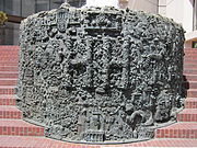
San Francisco Fountain
Fountain and sculpture by Ruth Asawa in San Francisco, California, U.S.

Street Artists Program of San Francisco
Municipal arts program

Union Square/Market Street station
Underground light rail station in San Francisco, California, US

Macy's Union Square
Macy's department store on San Francisco's Union Square